Unfolding the Map—the cartography of New Zealand
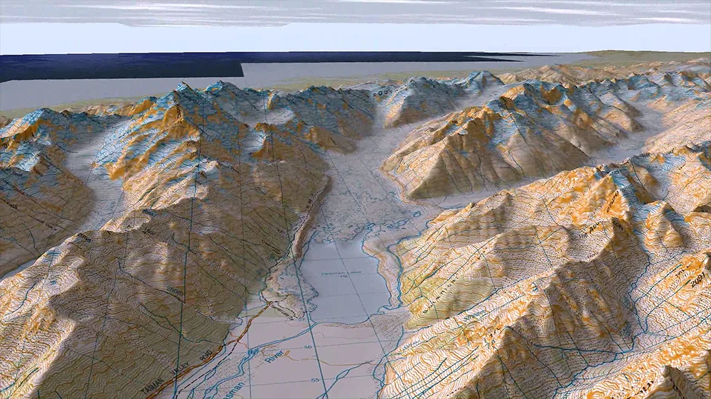
Tasman River Area, Roger Smith, Geographix. Used with permission. All rights reserved
Curated by Roger Smith, of Wellington based cartography firm Geographx, Unfolding the Map – The Cartography of New Zealand looks at the history of cartography in New Zealand, tracing its development from pre-European times through to the modern digital era of GPS and interactive mapping. At the National Library (Wellington): 16 October through most of 2016, it includes land maps, nautical maps, data visualisations and interactive maps.
It draws extensively on the map collections of the Alexander Turnbull Library and Archives New Zealand, and on the resources of New Zealand institutions and businesses working with the geographic information sciences.
Almost everything you wanted to know about maps is here, including some wonderfully named New Zealand places: Bilge Water, Bowels of the Earth, Rotten Tommy and Snuffle Nose.
The strong digital presence illustrates how mapping has changed from the days of hand drawn maps, including:
one map that provides a live feed showing in real time how winds move over New Zealand and our part of the Pacific.
a great video that highlights the various techniques that today’s mapping uses
a live illustration of the shadows cast by buildings in Wellington as the sun moves during the day
the ability to zoom over the Central Plateau and the rugged Southern Alps
There are also interactive iPads to explore modern digital mapping.
To illustrate New Zealand’s increasing diversity, people are invited to put pins on a world map showing where they were born and where their ancestors came from.
Programme for schools
We’re offering schools a free digital and analogue programme.
Activities are framed as structured inquiries, each beginning with the question, “What do you expect to see on a map?” Our Learning Facilitators will kick off class discussion on this key question with images of an interesting assortment of maps from the Alexander Turnbull collections.
This leads into a second question, “Can we create a map that makes sense of your life/your place?” followed by a discussion of a map’s common features, eg legend, orientation and how landforms are represented.
Younger students - up to year 6 - will create in pairs or small groups, an analogue (paper and ink) map that makes sense of the area between home and school. We can imagine the kinds of things that might be important, eg shops, friends, or scary dogs.
Older students will, following further exploration of digital maps (ie Google Maps), create the same kind of map, using the layers, drawing and labelling tools available on the ArcGIS platform on our iPads. This technology is powered by two partner organisations: Eagle Technology Group and the Walking Access Commission.
Bookings are essential. We are taking bookings now for the remainder of 2015, and into 2016.
To book a class visit, contact Anna Tiaki: anna.tiaki@dia.govt.nz
Phone: 04 474 3018
Image: Tasman River Area, Roger Smith, Geographix. Used with permission