- Description
-
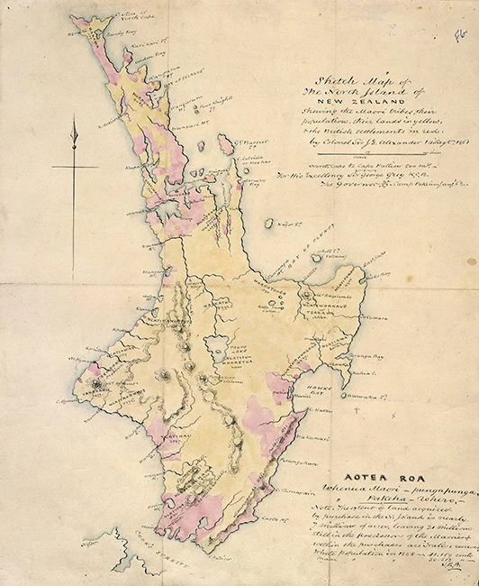
He mahere whenua e whākaatu ana i ngā rohe ā-iwi me ngā whenua Māori i te Ika a Māui, 1861. Kua oti ngā whenua Māori te tautohu ki te kōwhai, he whero ngā kāinga o te hunga mai Peretānia. Ko te nuinga o ngā whenua kei ngā ringa Māori tonu.
A map showing Māori tribal areas and land ownership in the North Island, 1861. Māori land is shown in yellow and British settlements in red. Most land is still in Māori ownership.
- Image credit
-
Sketch Map of the North Island of New Zealand Shewing the Maori Tribes, Their Population, Their Lands in Yellow & the British Settlements in Red, 1861. Ref: Map 2563 Auckland Libraries — Auckland Libraries Heritage Collections. No known copyright. Used with permission.
- Related content